No installation
Open AIRVLO and start working
Use AIRVLO in your browser. Projects are saved to your account and open from any computer
HYDRAULIC NETWORK DESIGN
Draw your water network on an online map, run hydraulic analysis and calculate estimated construction costs in one place. No installation required
WHY AIRVLO
AIRVLO keeps mapping, hydraulic analysis, CAD and estimated costs in one workspace
No installation
Use AIRVLO in your browser. Projects are saved to your account and open from any computer
Real-world mapping
Choose Streets or Satellite maps. Pipe lengths are automatically measured from their positions on the map
Automatic elevation
Elevations come from terrain data as you draw, or enter survey values manually
Cost estimation
Generate bills of quantities and cost estimates from your own unit prices. Estimates update as the design changes
Team collaboration
Edit a project together. See where teammates are working, and undo only affects your own changes
File compatibility
Open existing networks from .inp files. Export to .inp, DXF and .csv, cost reports to .xlsx and PDF, and print to PDF
HOW IT WORKS
Locate your project, draw the network, check hydraulic performance and prepare a cost estimate in one project
A DIFFERENT WAY TO WORK
When mapping, analysis and costing share one network model, you spend less time moving data and more time designing
EXPLORE THE WORKSPACE
Draw your network, manage its properties, run hydraulic simulations and prepare cost estimates without leaving your project
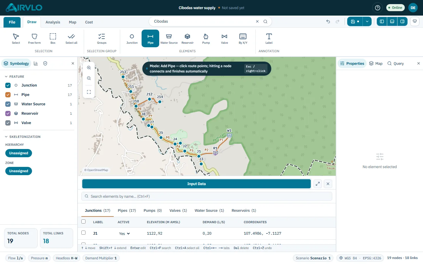
01: Draw
Place elements at their real locations and connect them with pipes. Lengths and elevations come from the map
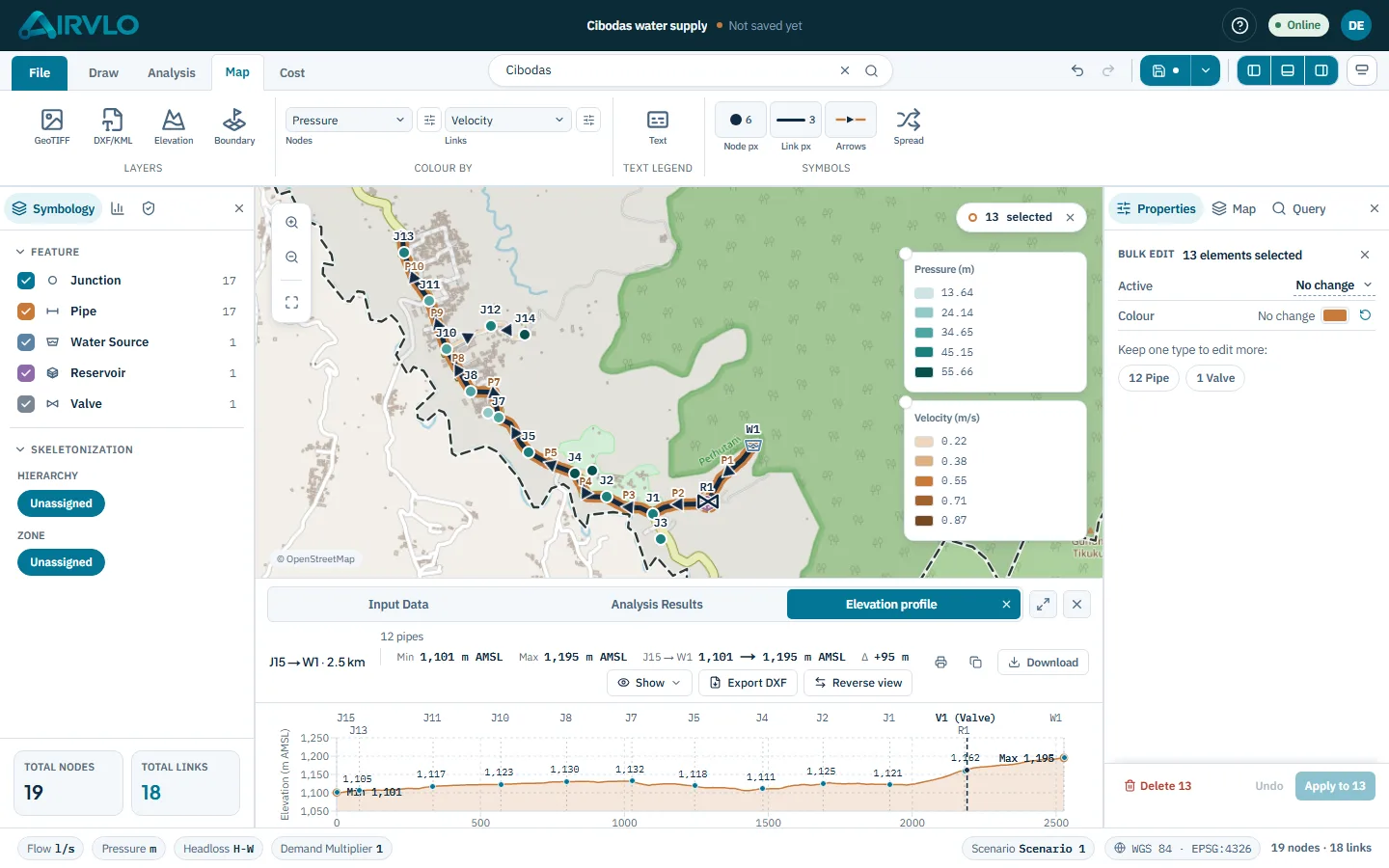
02: Map & Elevation
Use map layers, terrain elevations and reference drawings in your project, with no geographic data preparation elsewhere
Good to know Elevations come from a 30 m surface model, so rooftops, treetops and water may read incorrectly. Check key values against survey data. Boundaries are visual references, not legal ones
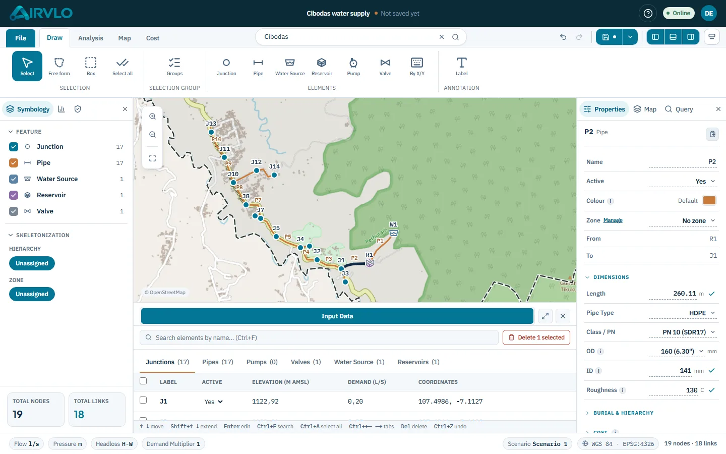
03: Properties
Edit properties in place, with undo. Indicators show whether a value follows a reference or was typed in
04: Results
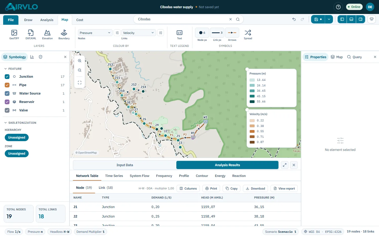
Review simulation results on the map, in tables and in charts. Validation jumps you to the affected element
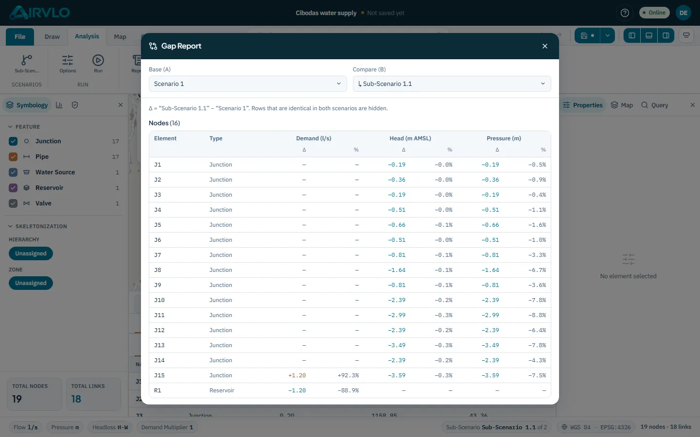
05: Scenarios
Compare network configurations without separate project files. Each sub-scenario stores only its changes from the parent
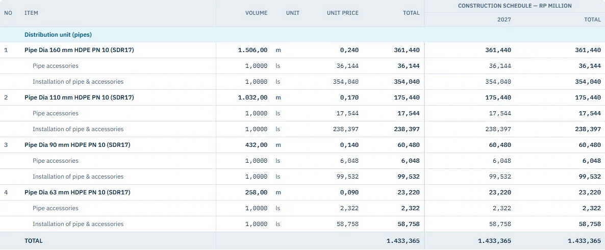
06: Cost
Prepare quantities and cost estimates from your design. Fittings and bends come from the drawing or a percentage of pipe cost, and excavation from your trench dimensions, at your unit prices
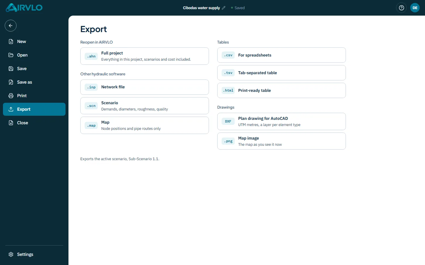
07: Files
Save online or locally, exchange data with other engineering tools and prepare scaled drawings
Good to know DWG and .net files cannot be imported directly. Save them as DXF or .inp first
FOR TEAMS
Keep your team on the same network model. Follow changes and restore earlier versions when needed
Draw, analyze and estimate the cost of your network in one workspace, whether it is your first network or a full project. Create a free account and start designing